Ahupua‘a Values
Part of "What is Kuleana Homesteading?"
An ahupuaʻa is a self-sustaining section of land that can stretch from the mountain ridges to the coral reefs in the sea. Within an ahupua‘a the Hawaiian people had access to the resources needed to sustain their community, watershed and ecosystems - fish and salt were at the river mouth, clean water was provided by streams for farming taro, sweet potato and other crops, fertile land was kept healthy with sustainable farming practices, and koa and other trees grew in upslope areas.
Ahupua‘a land use was determined by the characteristics of the land. Upland areas that could grow tall trees remained forested. The fertile valley floor surrounding a stream supported lo‘i for growing kalo. River mouths could be tranformed into fishponds.
What an ahupua‘a community could not make or get themselves, they could get from others by trading. Resources that were limited were conserved and placed under kapu to be available in the future, like the kapu placed on certain fish during their reproductive season. The Hawaiian islands are made up of several ahupuaʻa varying in size, from tens of acres to as large as 100,000 acres.
Understanding the role and people's histories within your ahupua‘a will help you to understand how to fulfill your kuleana to the land and water.
By understanding the ahupua‘a you will also begin to understand the interdependence of people and nature and the importance of the connections between them. When we are unaware or not involved in understanding our own ahupuaʻa, we are less able to mālama its resources.
Learn more about Ahupua‘a Values by visiting the Useful Links on this page. Start with the first link, a talk story video by Kamehameha Publishing with Earl Kawa‘a of Moloka‘i as he describes the Ahupua‘a of Hālawa. Then work your way through the other Useful Links. Ahupua‘a maps of six islands of Hawaii are included in the Useful Links for this Course segment.
> Back to Course 1:
Useful Links:

VIDEO: The Ahupua'a of Hālawa
Earl Kawa‘a of Molokai describes Hālawa
Valley and the many resources of the ahupua'a. Video production by Kamehameha Publishing for the Kumukahi.org education project.

Learn about Limahuli Garden & Preserve, its canoe garden and hale on the northside of Kaua‘i with past director Kawika Winter. From Hamline University's Center for Global Environmental Education.

Kawika Winter, PhD and past Director of Limahuli Garden & Preserve brings you through the bio-cultural zones on Kaua‘i, defined by ecosystems and human activity. From Hamline University's Center for Global Environmental Education.

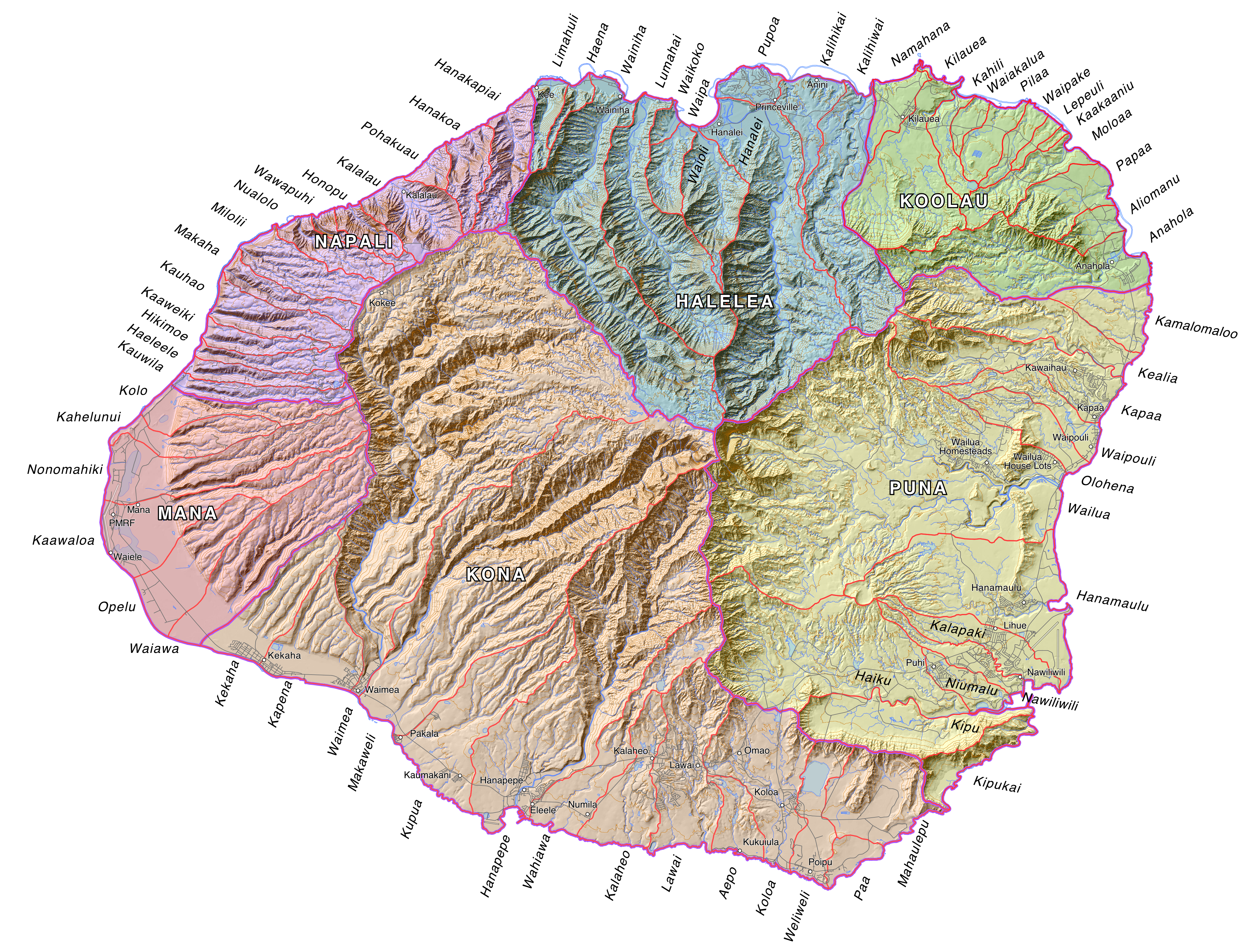
Ahupua‘a Map of O‘ahu
(from IslandBreath.org)
IslandBreath.org provides ahupua‘a maps of all Hawaiian islands.
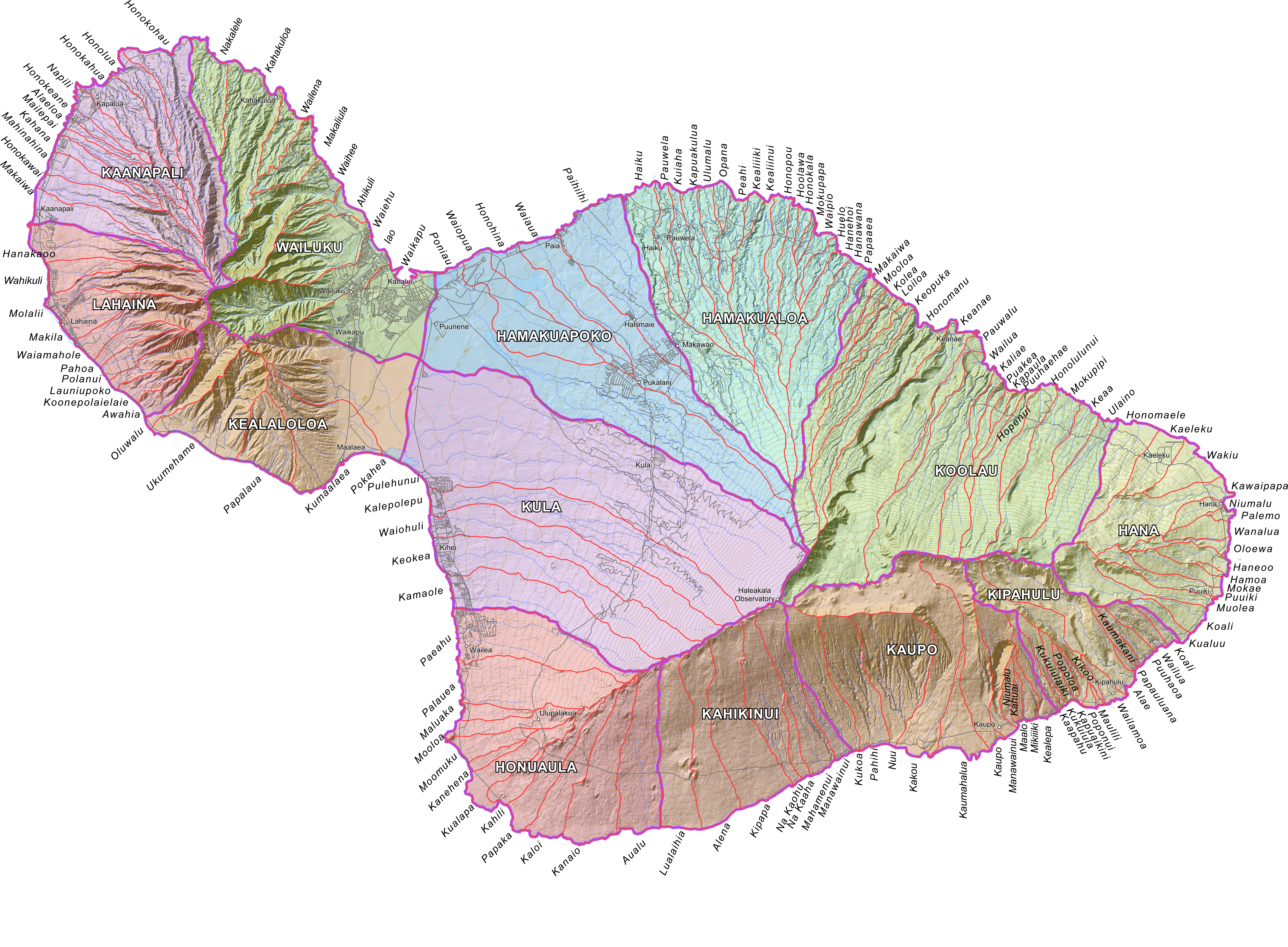
Ahupua‘a Map of Maui
(from IslandBreath.org)
IslandBreath.org provides ahupua‘a maps of all Hawaiian islands.
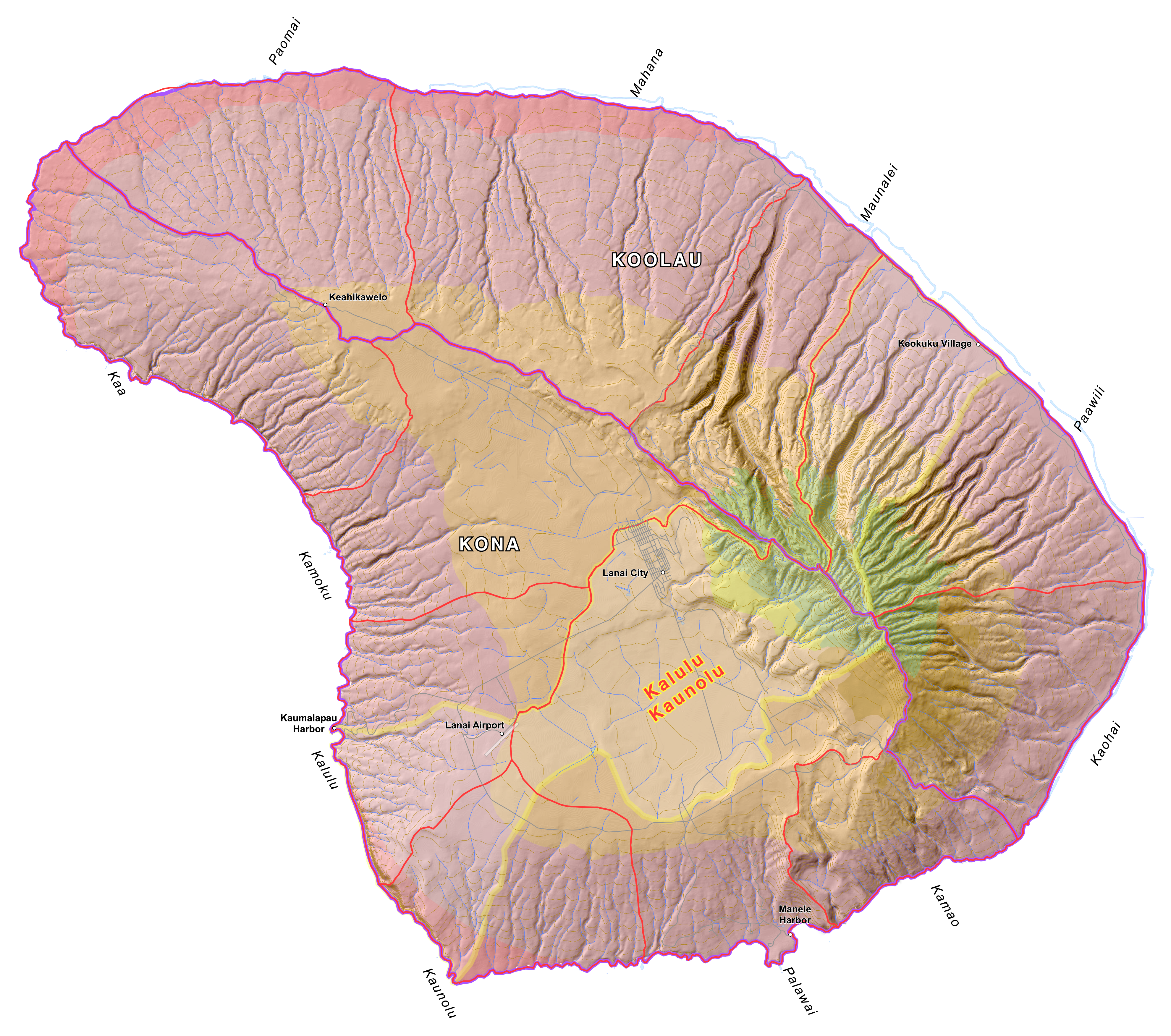
Ahupua‘a Map of Lana‘i from IslandBreath.org
IslandBreath.org provides ahupua‘a maps of all Hawaiian islands.

Ah Lan Kaulamealani Papa-Diamond of Waimea on Hawai‘i describes the interconnections of the ahupua‘a and how they help us understand that "we are part of the land." From WaimeaValley.net.

Poster: The Features of an Ahupua‘a
A depiction of the traditional ahupua‘a land division. From Bishop Museum Press.
IslandBreath.org has produced ahupua‘a maps of all Hawaiian islands.

IslandBreath.org provides ahupua‘a maps of all Hawaiian islands.

Ahupua‘a Map of Moloka‘i
(from IslandBreath.org)
IslandBreath.org provides ahupua‘a maps of all Hawaiian islands.